June 2022
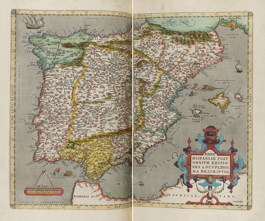
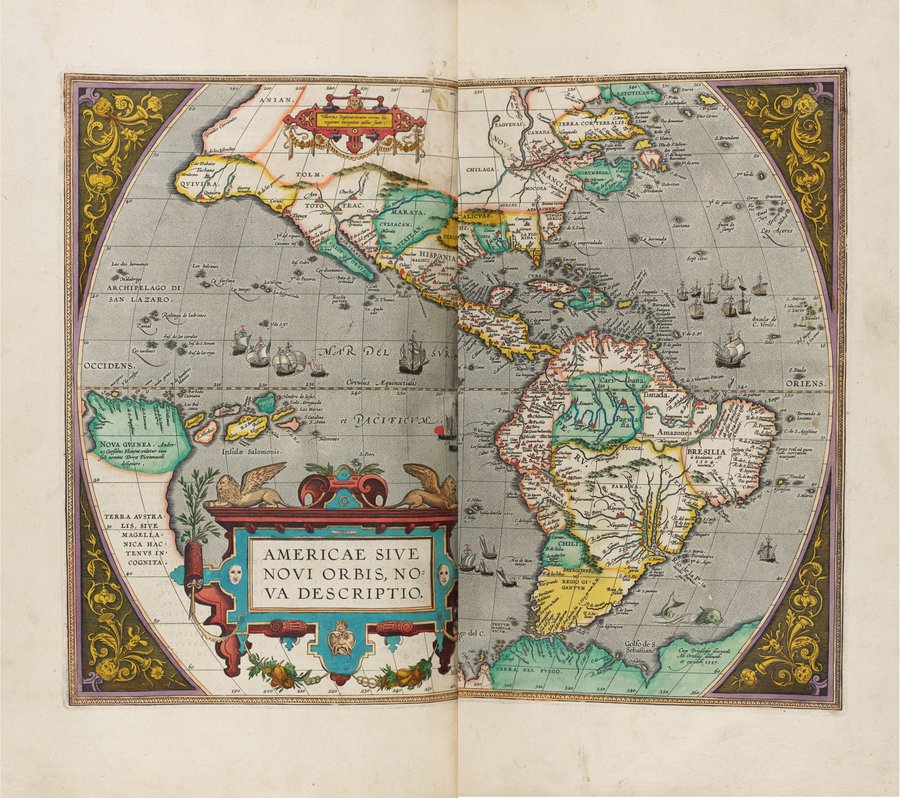
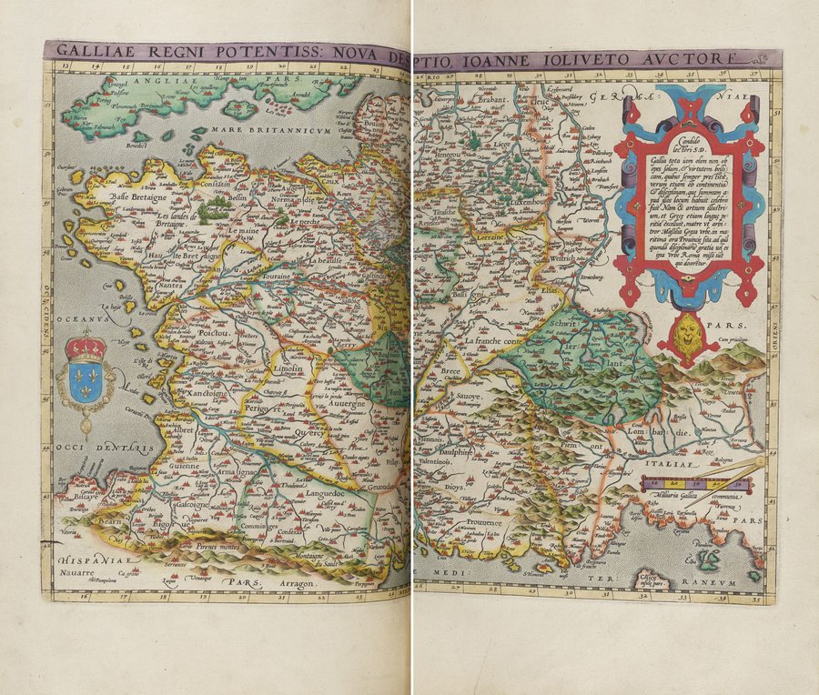
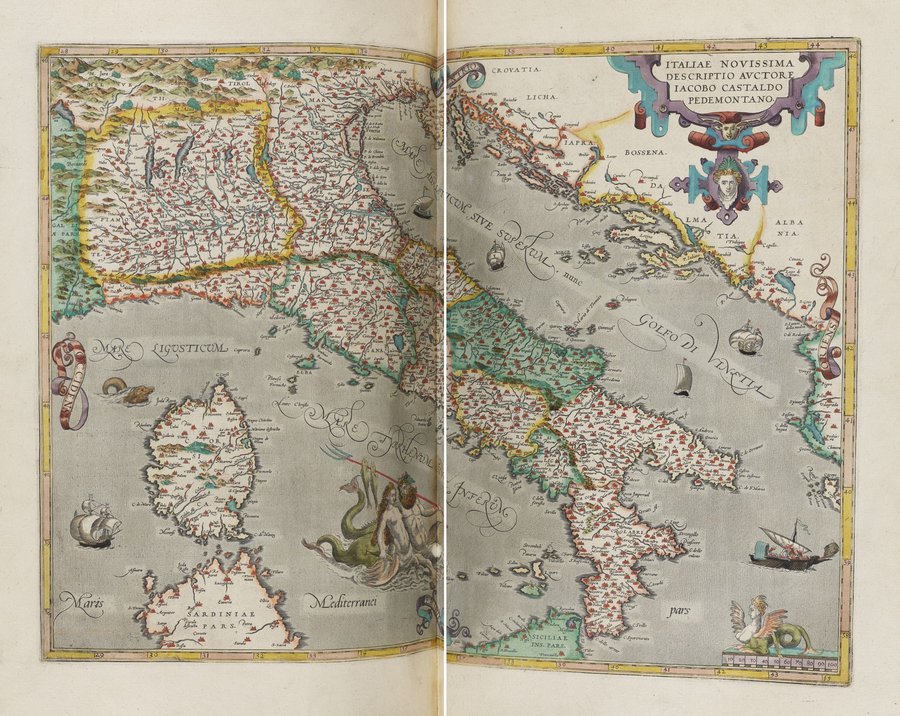
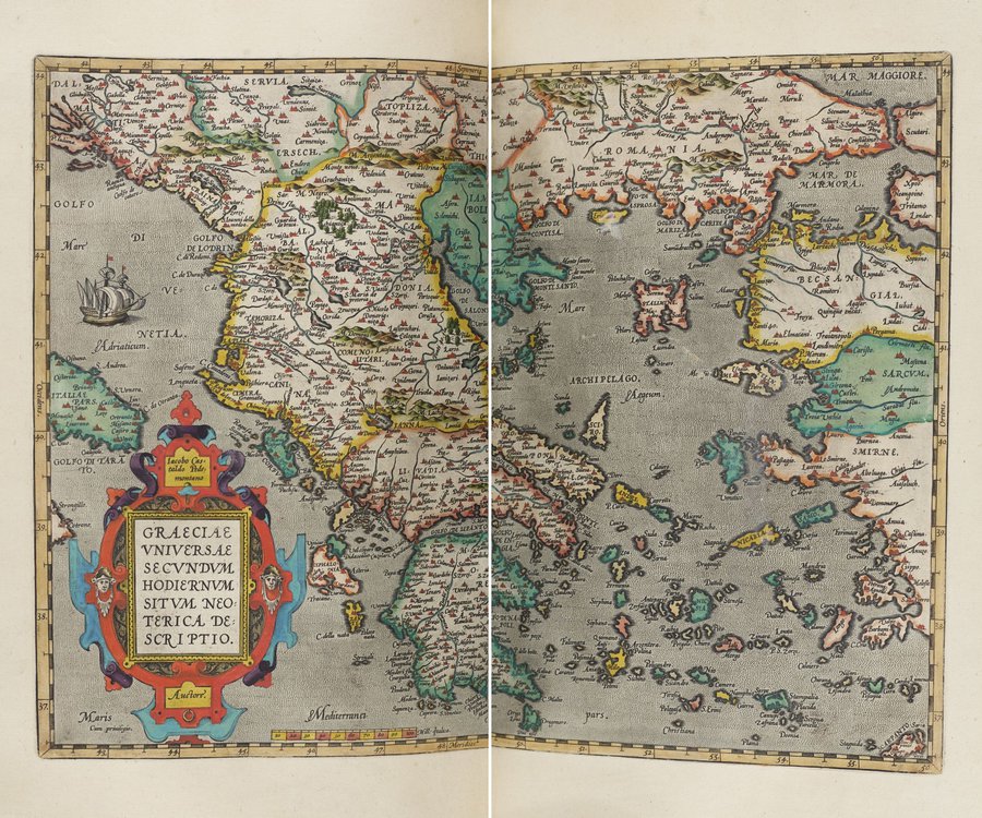
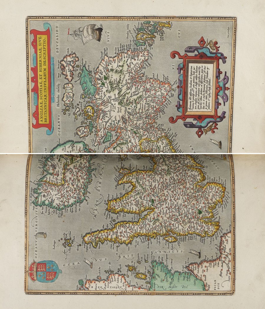
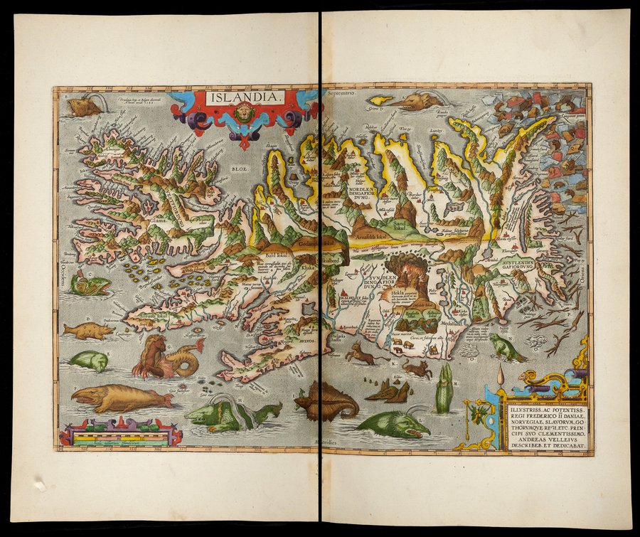
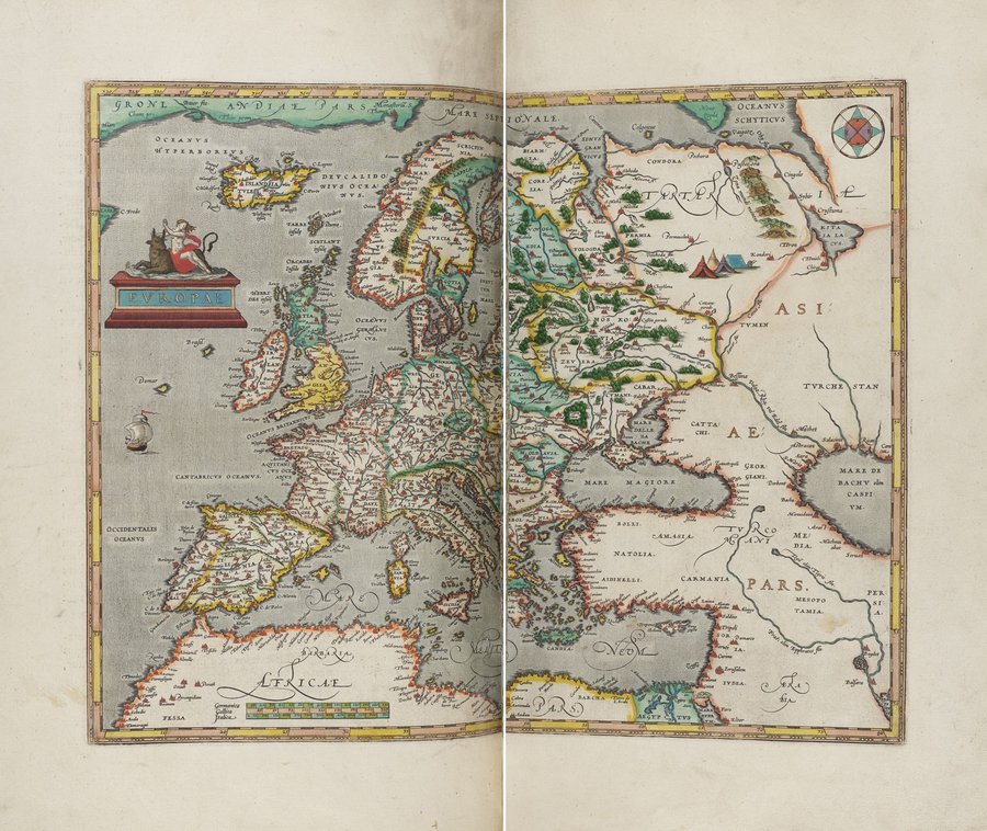
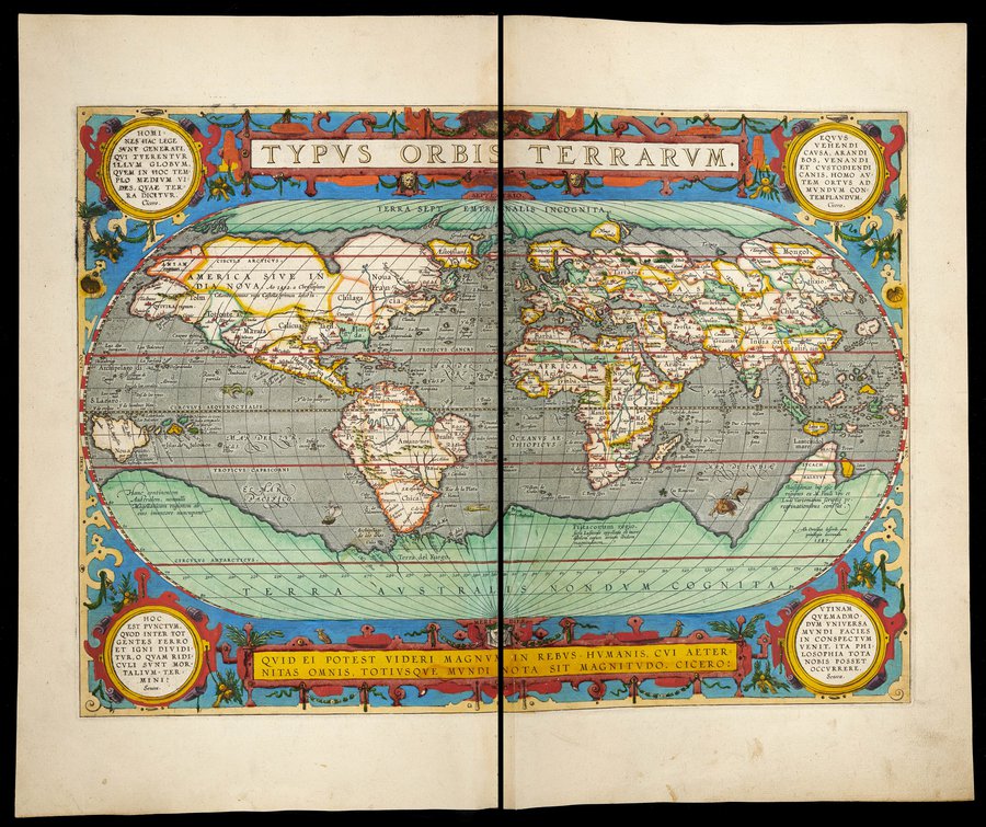
Abraham Ortelius, Theatrum orbis terrarum (Antuerpiæ, Apud Ioannem Bapt. Vrintium. Anno M.D.CIII [1603]) Shelfmark: Cpbd.c.2.lower shelf.4
It is June and finally the weather is warmer and the landscape greener. Moreover, the summer holidays are already in sight. This is a perfect occasion to look at one of the library staff’s all-time favourite book in St John’s College’s library: the Ortelius atlas.
Ortelius’s Theatrum orbis terrarum is generally considered to be the first modern atlas. Although Abraham Ortelius (1527-1598) was himself a cartographer, the 70 maps of the first edition had been created by others, as were the many additional maps of later editions. Still, Ortelius is rightfully credited as the first to create “a collection of uniform map sheets and sustaining text bound to form a book for which copper printing plates were specifically engraved”, published between 1570 and 1612 in “over seventy-three hundred copies […] in thirty-one editions and seven different languages” (Frans Koks, “Ortelius Atlas”, Library of Congress: Articles and Essays, at https://www.loc.gov/collections/general-maps/articles-and-essays/general-atlases/ortelius-atlas/ [accessed 18/05/2022]).
St John’s copy of the 1603 edition of the Ortelius atlas is hand-coloured to an exceptionally high quality. The hand-colouring was not part of the publication process. This luxury was usually commissioned by the purchaser according to their tastes and financial budget. The copy was part of the bequest by William Paddy (1553-1634), royal physician and one of the greatest benefactors of St John’s College’s library (as it happens, the May and March 2022 books of the month were also bequeathed by Paddy). No other ownership has been recorded for our 1603 Ortelius, so it logically follows that either Paddy himself purchased the copy and commissioned the hand-colouring or Paddy purchased the volume from a previous owner or it was given to him by a previous owner (although the question remains whether or not the atlas had already been hand-coloured by the time it entered Paddy’s possessions).
The maps chosen for this Book of the Month feature some of the most popular holiday destination of the British people (Spain, USA, France, Italy, and Greece) and, for those who prefer a holiday closer to home, a map of the British Isles. Also added is a map of Iceland, simply because it is the library staff’s favourite map (can you find the brown polar bears?). Finally, there is a map of Europe and a world map.
St John’s College has three other copies of the Ortelius atlas among its holdings. Our copy of the 1579 edition is hand-coloured, too, but not to the quality of our 1603 edition. Unfortunately, our copy of the first edition, donated by Archbishop William Laud, survives only in fragments after it fell victim to fire of an unknown date. This copy was coloured by hand with a light touch, focusing on rivers and other landmarks. Laud also donated a copy of the 1612 edition, which is not coloured at all; it a surprising impression to those used to the coloured maps.
If you’d like to find out more about the Ortelius atlas and see images of our other copies, check out our blog post at https://stjohnscollegelibraryoxford.org/2016/10/31/abraham-ortelius-theatrum-orbis-terrarum/